


GeoSmart II (Soil Investigation Software Plus AGS Tool )
GeoSmart Monitoring Tools
GeoSmart II is a powerful software tool for all the ground investigation workings. The software is user-friendly with powerful functions on all the soil investigation reporting works such as soil borelog and soil cross section drawing, report summary, invoice tool and AGS transport tool.
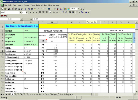
Data Entry:
Data Input in an Excel file. Easy input following the title of the column.
One project for one file, one sheet for one borehole. And it is also easy to shear the data by copy and paste the sheets between the data files.
The data file is a normal Excel file which can be copied to any PC to do the data input without any software license.
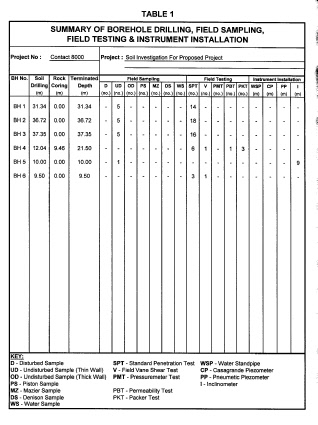
Summary Function:
Provide summaries of project data based on the data input, the summaries can be used as invoice information of report directly.
Summary of Borehole Drilling, Field sampling, field-testing.
Summary of Lab Test Result or Lab Test Quantities.
More summary table can be customize based on the data file.
Summaries in Excel data file also, can be printed out directly.
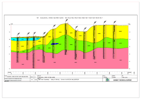
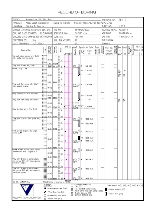
Borelog And Cross section Function:
Automatic draw the borehole log in AutoCAD file by one click on the GeoSmart II menu. Save and print the file for report use directly.
Automatically create the soil cross section based on same data file. The cross section include soil logs and CPT logs and present in more than 10 layers in AutoCAD drawings. On and off any layers can show the different presentation of the cross section.
Provide AutoCAD hatch pattern for soil and rocks based on BS standard.
Borehole log format can be customize. The output file is a normal AutoCAD file, which can be, edit and plotted to many different file type (.DWG, .DXF, .JPG, .PNG, .DWF…)
Smart AGS Transport Tool
Transfer data from GeoSmart Excel data file to AGS Excel data file.
Transfer data from AGS Excel data file to AGS format file.
Load relative data from AGS format file to GeoSmart II data sheet.
Open environment in AGS Excel file for user to add unlimited AGS group or user define AGS group.
Transport data between GeoSmart data sheet to KeyAGS Excel data File.