
Software products
Explore GeoSmart software, AGS Rules Checker, and GeoSIMS, a web system under user testing.
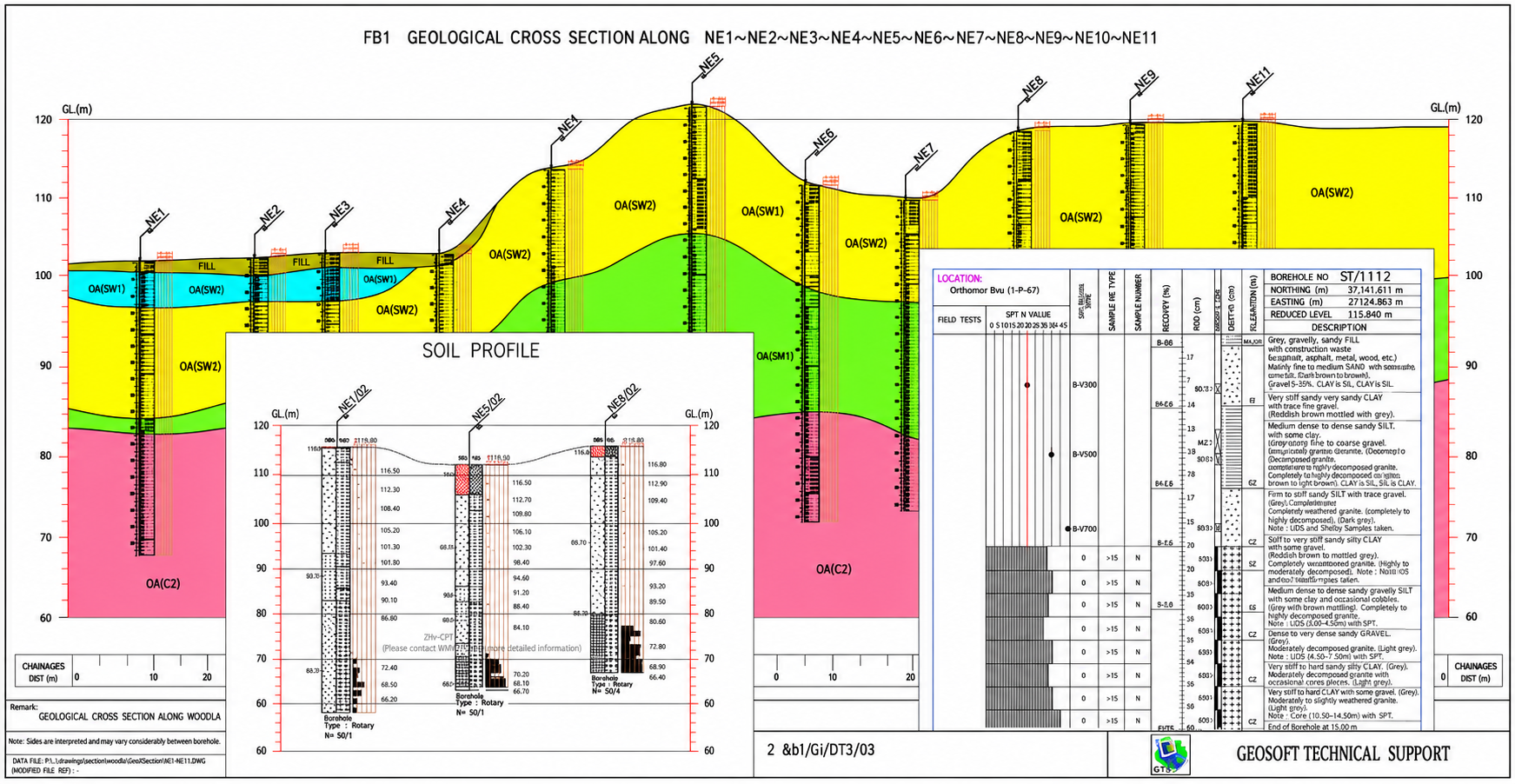
Streamline borehole logging, laboratory data, and cross-section reporting with an Excel-native workflow tailored for geotechnical investigation teams.
- Excel-native templates for field and laboratory data
- Automated borehole logs, soil profiles, and cross-sections
- AGS transport tools for seamless data exchange
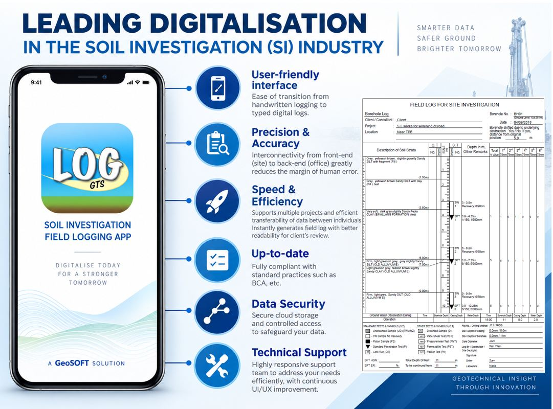
Capture soil investigation data on-site and export JSON or AGS files for office processing with GeoSmart III.
- Native mobile workflow for borehole logging and test records
- Instant PDF, AGS, and JSON exports for office processing
- Photo capture, cloud backup, and Google Maps integration
- JSON export for import into GeoSmart III
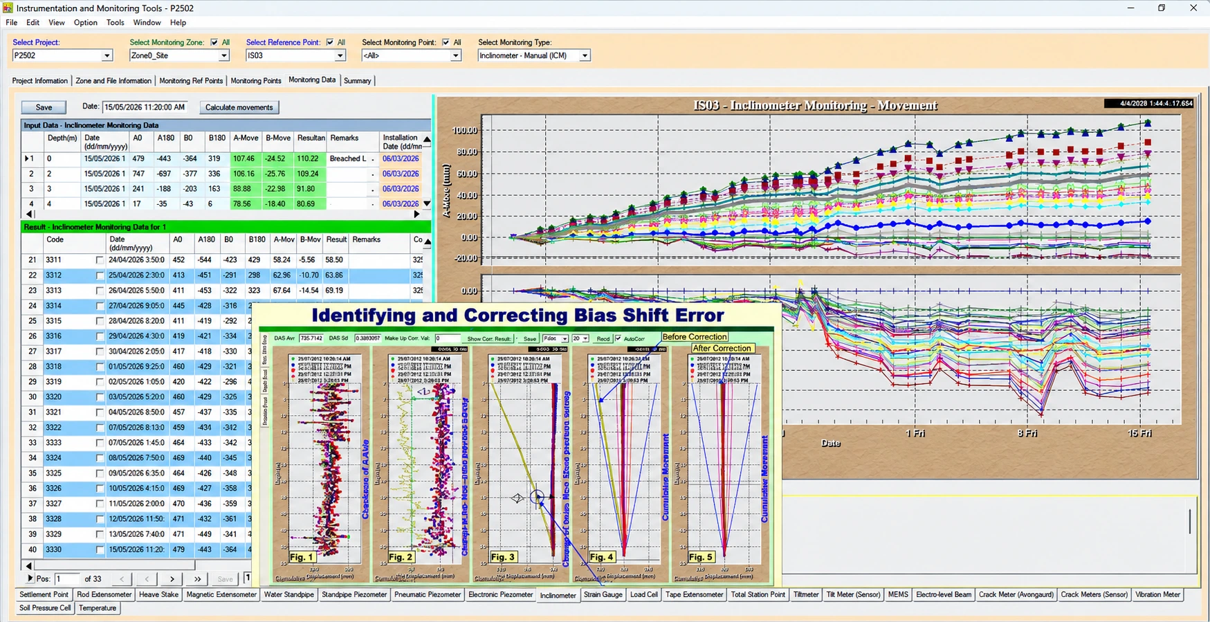
Use desktop software to calculate, analyse, chart, and report instrumentation data for settlement plates, piezometers, inclinometers, and more.
- Project, zone, monitoring point, and reading data model
- Flexible charts with exportable visuals and summaries
- Specialist analysis tools (including inclinometer QA and alerts)
- Flexible reporting templates for daily/weekly/monthly submissions
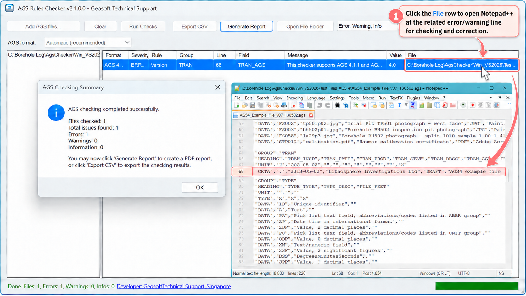
Check AGS 3.1, AGS 4.1.1, and AGS 4.2 files with automatic format detection. Review errors, warnings, and information before submission.
- Automatic AGS format detection
- Issue list with file and line details
- CSV export and TXT/PDF reports
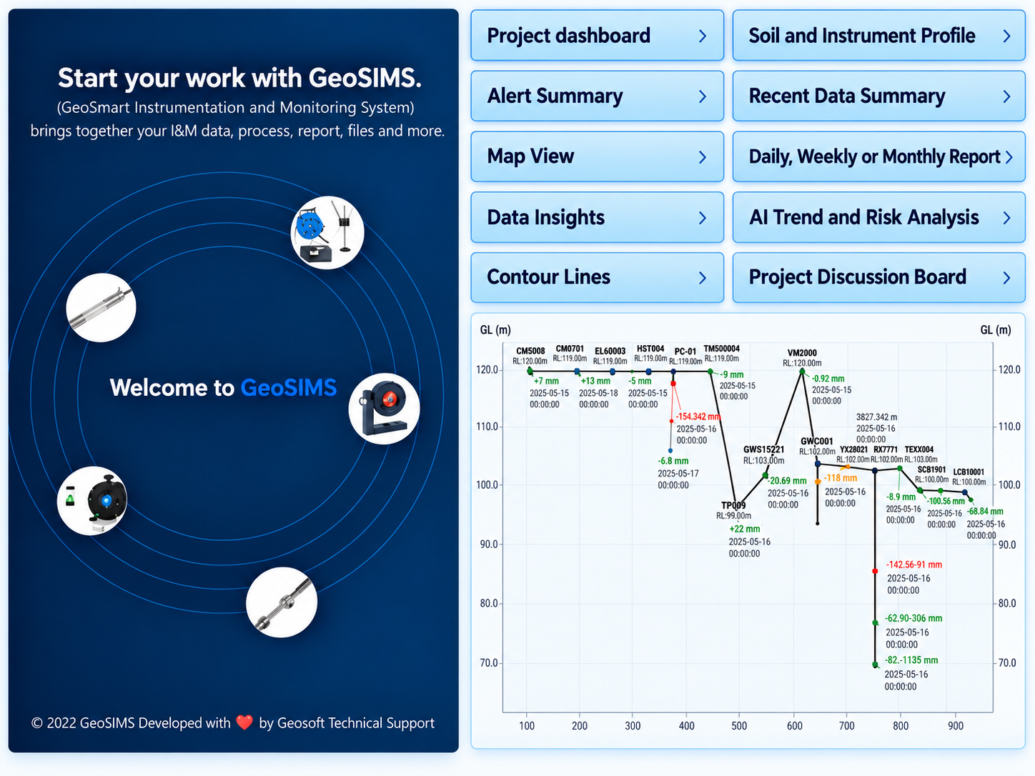
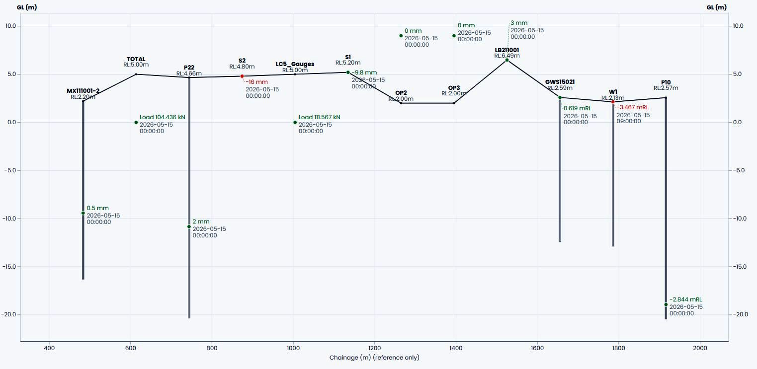
Illustrative GeoSIMS overview supplied September 2026; instrument profile updated October 2026. GeoSIMS is under user testing; Project Discussions and AI advisors are Beta, and AI outputs require engineering review.
- Project dashboard
- Map View
- Data Insights
- Alert Summary
- Monitoring reports
- Project DiscussionsBeta
- Trend & Risk AdvisorsBeta
GeoSIMS is a web-based instrumentation and monitoring system under user testing. It brings monitoring data, processing, reports, and files into one workspace, with a dashboard for project and zone activity, instrument coverage, field status, and alert breaches.
- Project- and monitoring-zone dashboard
- Instrument readings, field status, alerts, and reports
- Project Discussions and AI advisors are in Beta testing